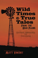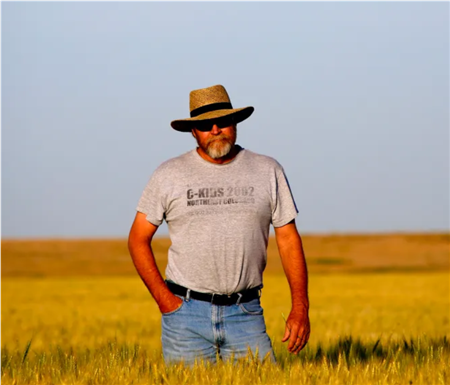
Narratives of the early settlement of Colorado, Kansas, and Nebraska took center stage at our April 10 meeting as Matt Vincent, a fifth-generation Colorado resident and retired journalist, summarized the background and contents of his book, “Wild Times & True Tales from the High Plains".
From one of the 17 chapters in his award-winning book, Vincent explained the basic surveying process that was used to chart the vast North American interior in the 1850s. Specifically, Vincent explained the mathematical formula to pinpoint the 6th Principal Meridian. All land surveys, he noted, were based on the “English Mile” of 5,280 feet. Using a 66-foot length of chain and starting at the 40th Parallel on the west bank of the Missouri River, survey crews then slowly moved west with their chains, transits and compasses, measuring 80 increments with a 66-foot chain to mark each individual mile. (80 x 66 = 5,280 feet). They repeated this process 108 times, while incorporating “correction lines” every nine miles to adjust for the curvature of the earth.
Vincent also devoted a chapter of his book to the “Miracle Cures for Early Settlers,” explaining the origin of “Snake Oil,” which first arrived in the U.S. with Chinese immigrants who assisted with the construction of the transcontinental Railroad. Original “snake oil” formulas were extracted from Asian water snakes and contained beneficial ingredients such as Omega-3 acids to sooth arthritis and sore muscles. Unfortunately, a Texan named Clark Stanley began marketing a version of snake oil with ingredients like rattlesnakes, turpentine, pepper and liberal amounts of alcohol.
From another chapter, Vincent described the catastrophic “Spanish Flu” pandemic of 1918. He noted that so many residents died in the Texas Panhandle that funeral homes ran out of caskets and were forced to bury victims in mass graves.
Vincent spoke briefly about the origins of names and places on the High Plains, noting connections to railroads, the military and to the indigenous people. He noted that Fort Collins was founded as “Camp Collins” near present-day LaPorte in the early 1860s and was named for Lt. Col. William Collins, commander of the 11th Ohio Cavalry stationed at Fort Laramie. The military outpost was eventually relocated to higher ground near present-day “Old Town” and staffed by members of the 1st Colorado Volunteer Cavalry. The future of Fort Collins was assured with the arrival of the Central Colorado Railroad in 1877 and the founding of Colorado Agricultural & Mechanical College two years later.
Vincent finished his presentation by explaining how he published his second book in late 2022 titled “The Chronicles of Custer: First Stand of a Failed Campaign,” which provides readers of western history with the harsh truth behind the ill-fated Hancock Expedition of 1867 during which Lt. Col. George Armstrong Custer traveled across the plains of Colorado, Kansas and Nebraska during his first western field campaign. The author’s interest in Custer began when the late Jim Brophy, a longtime resident of Yuma County, showed him a discarded saber that was found in a pasture north of Eckley in the 1960s. Brophy then asked Vincent to “look into it.” Through extensive research that took him to the National Archives and Library of Congress in Washington D.C. and more than 1,000 miles across the tri-state region, Vincent eventually discovered the “how, where, why and how” behind the Brophy saber. Ralph Smith concluded the meeting by observing that Mr. Vincent’s photographs of farms and ranches celebrate the community and well-being of the northeastern Colorado region.